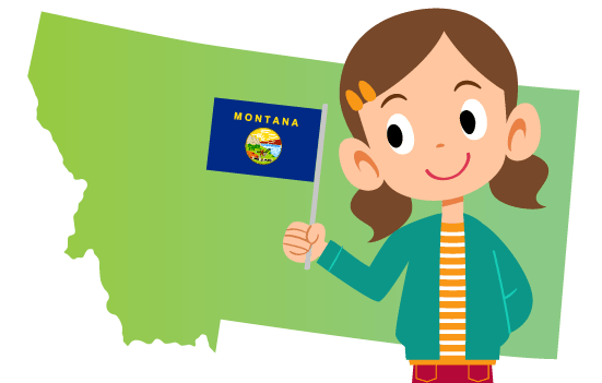
What do you think of when you see or hear the word “Montana”? Montana is a state in the northwestern United States that gets its name from the Spanish word “montaña,” which means mountain or mountainous region. However, among the mountain states in the US, it has the lowest elevation, and the eastern part of the state is covered with rolling plains. Although it is the fourth largest state by area, it is also the third lowest in population (just over one million)!
In this article you’ll learn interesting facts about Montana, including a Montana history timeline, geography facts and more. Time4Learning members can download our list of PreK-12 interactive activities that align with your study of Montana. Here are a few quick Montana facts for students:
Montana Fast Facts
|
Became a State: |
November 8, 1889 |
|---|---|
|
Order it Joined the Union: |
41st state |
|
State Capital: |
Helena |
|
State Abbreviation: |
MT |
|
Border States: |
|
|
State Flag: |
|
|
State Song: |
|
|
State Flower: |
Bitterroot |
|
State Nickname: |
Treasure State, Big Sky Country |
|
Notable Montanans: |
|
Historical Facts About Montana
Montana’s human history began about 7,000 years ago, with Plains Indians arriving in the 17th century from the east. By the nineteenth century, Montana was inhabited by the Crow, Cheyenne, Assiniboin, Atsina, Blackfoot, Kutenai, Pend d’Oreille, Kalispell, and Flathead tribes.
When Europeans expanded westward beginning in 1804-1806 as a result of the exploration of Meriwether Lewis and William Clark, Native Americans were moved to reservations. Trade was established between fur trappers and Native Americans, and Roman Catholic missionaries followed. Routes eastward from the north (Overland Route), from the southeast (Bozeman Trail), and westward from Fort Benton (Mullan Road) were created.
Like many other western states, Montana’s history was very much affected by the gold rush and mining. In the 1860’s, prospectors raided the area, and by the time Montana became a state in 1889, Montana was already becoming one of the nation’s top copper mining areas. Butte became known as the “Richest Hill on Earth.” The “War of the Copper Kings” allowed the Anaconda Company to become powerful in Montana, influencing politics, eliminating mining unions, and taking over the daily newspapers. In essence, Marcus Daly and the Anaconda Company controlled Montana for three-quarters of a century.
The state is nicknamed “The Treasure State” because of its mineral riches, and its state motto is “Oro Y Plata” (gold and silver), but the 1980s marked a change in Montana’s history as the economic focus moved from copper to tourism.
Read the Montana history timeline below to learn important Montana history facts through the events that occurred in this state.
1803
US acquired part of Montana through the Louisiana Purchase1804
Meriwether Lewis and William Clark arrived in Montana1841
Saint Mary’s Mission, the first permanent settlement was established by Roman Catholics near Stevensville1846
Fort Benton was established, the only trading post to survive to present day The Oregon Treaty gives the rest of Montana to the U.S.1864
Federal government established the Montana Territory which was signed into law by President Abraham Lincoln.1876
Dakota Sioux and Cheyenne won their last major victory against General George A. Custer and the 7th Cavalry in the Battle of Little Bighorn1877
Nez Percé won a battle in Big Hole Basin but were defeated just south of the Canadian border1886
Severe winter greatly reduced herds of cattle1889
Montana became the 41st state in the US under President Benjamin Harrison1894
Helena is named the state capital by Montana voters after a controversial election1900
Pioneers arrived to grow grain, which was not successful1915
Natural gas and petroleum production began in the plains of Montana1972
Montana’s constitution was replaced with a revision that included voter review of the government every 10 yearsBring history and geography to life with Time4Learning’s interactive online social studies curriculum for grades 2-12.
Montana Geography Facts
Montana’s economy is based on agriculture, mining, forestry, and energy, with about a third of the population working in service industries including outdoor recreation. The state relies on its natural resources for hydroelectric power (about a third of its electricity production), forestry materials, irrigated crops, and coal and petroleum reserves.
Like its name suggests, Montana contain mountains. The Rocky Mountains were carved by glaciers over 11,500 years ago, but the glaciers have greatly decreased in size over time. There are also eight small areas of the Rockies, called “outliers” spread out among the plains. Mountain wildlife include grizzly bears (the state animal), gray wolves, mountain lions, Rocky Mountain goats, bighorn sheep, American elk, mule deer, bobcats, moose, and forest grouse. The eastern three-fifths of the state makes up part of the Great Plains. These plains are home to large numbers of grazing cattle and sheep and few humans. Wildlife includes pronghorn, mule deer, badgers, coyotes, and plains grouse.
Because of its unique geography, Montana is the only US state that has waters draining into Hudson Bay, the Gulf of Mexico, and the Pacific Ocean. Its climate consists of hot summers and cold winters, with a warm winter wind known as the Chinook that breaks up the cold temperatures and over 200 days of frost per year. The contrast between the golden rolling plains and the high mountains, deep valleys, forested slopes, and treeless crests create breathtaking views.
Check out this map of Montana to start getting familiar with the state. Then read through the following Montana geography facts. Print out the map of Montana provided below and add these items to the map.
- Montana is bordered by North Dakota and South Dakota to the east, Wyoming to the south, Idaho to the west and southwest, and three Canadian provinces (British Columbia, Alberta, and Saskatchewan) to the north.
- The capital of Helena lies near the middle of the western half of the state.
- The Rocky Mountains lie in a diagonal line from the northwestern to the middle southern parts of the state.
- Glacier National Park is in the northwest corner where the Rocky Mountains enter Montana from the north.
- The Great Plains lie to the east of the Rocky Mountains.
- The Missouri River flows in the north central part of the state into North Dakota.
- The highest point in Montana is Granite Peak (12,799 feet), located in Yellowstone National Park in the south-central part of the state.
- The lowest point in the state is on the Kootenai River (1,804 feet), located on the Idaho border.
Montana State Map
Download our FREE Montana state map printable. Use it as a coloring page or use it to plot the state’s geographical features.
Activities for Children in Montana
Want to discover more fun facts about Montana? Come and enjoy the geography and culture that have attracted tourists for years. Homeschoolers in Montana can take a day trip while visitors to the state may be able to plan an extended stay to see some of the state’s most interesting places. Here are some opportunities to learn more about Montana facts for kids:
- Glacier National Park (Various Locations): Take a car ride up the Going-to-the-Sun Road to experience mountains, lakes, meadows, and forests. Hike on over 700 miles of trails, go biking, skiing, or just enjoy the views and wildlife. At the Crown of the Continent Research Learning Center, adults and high school students can get involved in species identification and data collection through the citizen science program or participate in BioBlitzes, brown bag presentations, and other programs.
- Museum of the Plains Indian (Browning): See this permanent gallery featuring exhibitions showcasing the Northern Plains tribes. See carved wood panels, murals, and dioramas. Find weapons, clothing, horse gear, household items, and children’s objects.
- Museum of the Rockies (Bozeman): This Smithsonian-affiliated museum is known for its dinosaur fossils, including a full-scale Tyrannosaurus Rex. See a living history farm, learn about Yellowstone, and enjoy the planetarium. Access the classroom resources on the museum’s website to view lesson plan ideas related to paleontology, astronomy, Yellowstone, Indian education, and homesteading/agriculture. Livestream events are also available for distance learning, and two educator guides can be downloaded to help your family explore earth space science and the world of dinosaurs.
- Yellowstone National Park (Various Locations): Visit America’s first national park and experience the power of a volcano through geysers, mudpots, and hot springs. See wildlife, mountains, forests, and waterfalls by hiking, biking, or horseback riding. Interact with nature through fishing, boating, swimming, skiing/snowshoeing, riding a snowmobile or snowcoach, or camping. Learn about heat-seeking organisms called thermophiles, become a Junior Ranger or Young Scientist, or enjoy a guided tour. Get closer to grizzly bears and wolves in the Grizzly & Wolf Discovery Center. Before your visit, or if you are unable to visit, take advantage of the online Exploration Themes to learn about this amazing park!
Looking for more things to do with your kids in Montana? Check out this post full of field trip ideas in Montana!
Montana Freebies and Deals for Homeschoolers
You can learn more Montana facts and information for little to no cost. Below are just a few ideas:
- Archie Bray Foundation for the Ceramic Arts (Helena): Take a free self-guided tour of the grounds to see ceramic art sculptures. Enjoy a rotating exhibition space and warehouse gallery. Workshops and classes are also available for a cost, and items can be purchased, but you can visit the site without an investment.
- Fort Benton (Fort Benton): Step back in time and take a free self-guided tour of Montana’s early trading post. View the Lewis & Clark Memorial, see the statue of the faithful dog “Shep,” and learn about the “bloodiest block in the west.” Take a walk along an old steamboat levee or on the first bridge on the Missouri River, or just enjoy the scenic Upper Missouri River and the outdoor art. The site is located near eight museums, but they do charge admission.
- Little Bighorn Battlefield (Crow Agency): Explore the battlefield, photo galleries, and artifacts depicting the famous clash between the US Calvary and the Northern Plains Indian tribes. See gallery objects and images of George A. Custer’s military commission documents in person or online or explore the graves in Custer National Cemetery. Junior Ranger booklets are available at the Visitor Center. Anyone 15 years or younger does not pay admission, and there are several fee free days per year.
- Western Heritage Center (Billings): Visit this history museum to learn about the people and locations within the Yellowstone River Valley and Northern High Plains. Explore exhibits, visit the 1901 building, and access online resources. Admission is $5 for adults and $1 for children under 12, and you may be able to catch a fee free day.
Montana Learning Games for Children
Now that you know some interesting things about Montana, test your Montana facts knowledge with these free games and activities:


